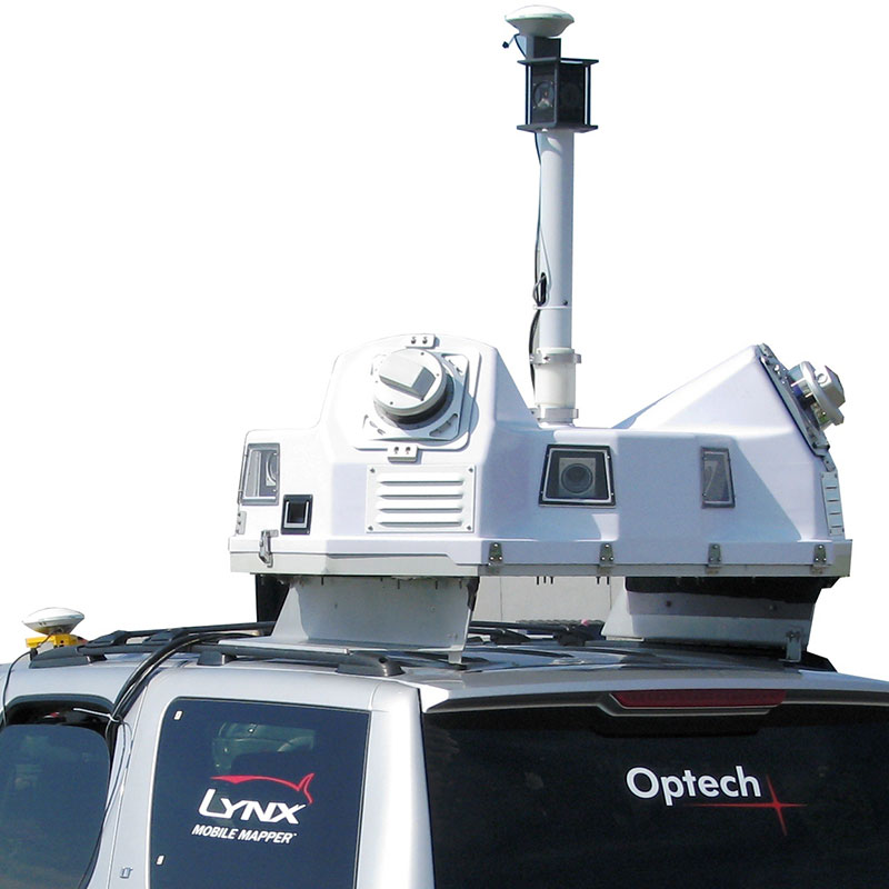
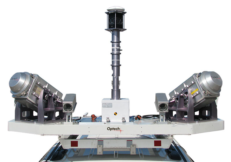
Optech Lynx SG1 Mobile Mapper

The Lynx Mobile Mapper™ SG1 has two 600-kHz sensors for survey-grade precision. It’s the fastest and most efficient mobile lidar mapping system available, with incredible detail and measurement rates of up to 1.2 million measurements per second. Collect engineering survey-grade lidar and image data from a vehicle at cruising speeds, while previewing the quality of your data in real-time 3D inside the vehicle. The ability to control several integrated cameras, including the Point Grey Ladybug®, adds further value to a system that is already considered the premium choice for mobile surveys where accuracy, precision and resolution are critical. A complete software solution includes best-in-class survey planning, project execution, inertial/position processing, lidar post-processing and information extraction. The Lynx SG1 leverages the lidar rectification power of Optech LMS Professional, which rectifies lidar data files to such a level of accuracy and quality that they require no further refinement, independent of the user. This minimizes processing time and maximizes efficiency while generating consistent results.
Lynx SG1 Advantages
- Achieve engineering-grade detail as your deliverable collecting 1.2 million points per second
- Get closer, denser points where needed with a fast PRF of 600 kHz per sensor head
- Gain efficiency in survey planning and scheduling with programmable scanner speeds
- Multiple mobile platforms expand your applications to road, off-road, rail and marine
- Up to four individually addressable and scalable cameras provide results matching project needs
- Automated lidar rectification algorithms maximize accuracy of airborne and mobile surveys
- Flexible image capture reduces your data volume
Applications:
- Corridor & Asset
- Asset Management
- Transportation
- Utilities
- Engineering
- Civil Engineering
- Rail
- Surveying & Mapping
- Digital Photogrammetry
- Urban Mapping