
TABI-1500
TABI-1800 Industry’s widest-array, internally cooled broadband thermal imager
The TABI-1800 is a thermal broadband imager which follows the same philosophy as the TABI-320 while offering new technologies which improve sensitivity and increase the swath from 320 pixels to 1800 pixels.
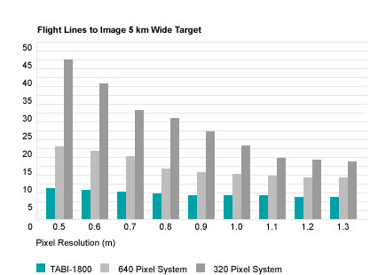
TABI-1800 has excellent sensitivity due to its stirling cycle cooled MCT (mercury cadmium telluride) detector, allowing users to distinguish temperature differences as low as one tenth of a degree while diminishing thermal drift as compared to bolometer-based systems. This new imager’s 1800-pixel swath allows users to map large areas in a very small time frame.
features:
- Widest pixel resolution: The industry’s widest achievable pixel resolution range (10 cm to 1.25 m possible with typical unpressurized fixed-wing aircraft; ~2 cm resolution using a helicopter)
- Thermal resolving power: High thermal resolving power (0.05 degrees Celsius)
- Wide imaging array: Wide imaging array of 1800 pixels
- Custom optics: Our trademark high-performance custom optics which are truly diffraction-limited with sub-pixel optical spot size for superb focus.
- Simplified installation: Simplified installation as the controller, digital recording system, and precision GPS/IMU are all built into the sensor head.
- Spectral programming: to suit wide range of applications
Line Cost Savings vs Competing Imagers (up to 83%)
The controller and digital recording system is built into the sensor head. This simplifies its tidy installation in a standard air photo port commonly found in a wide variety of aircraft.
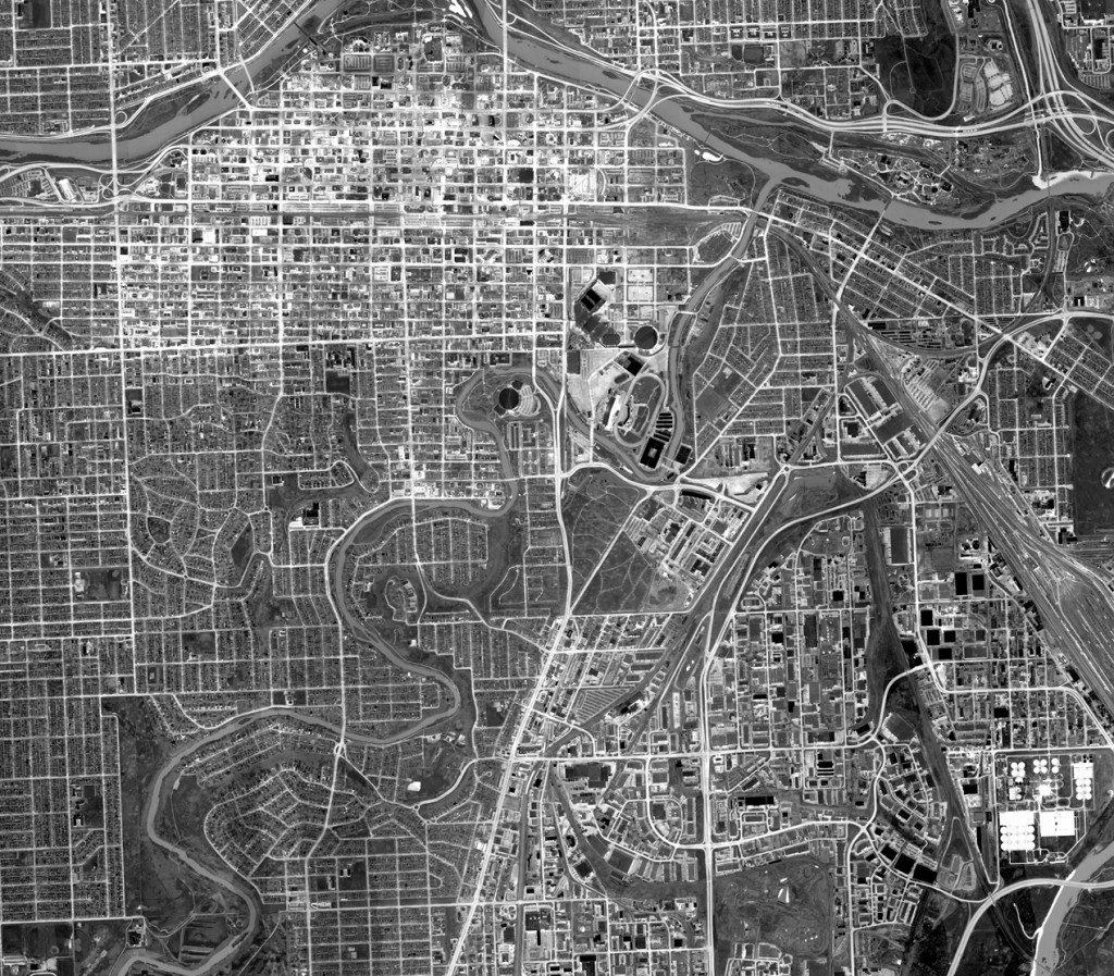
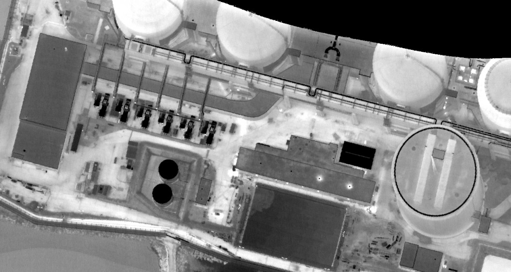
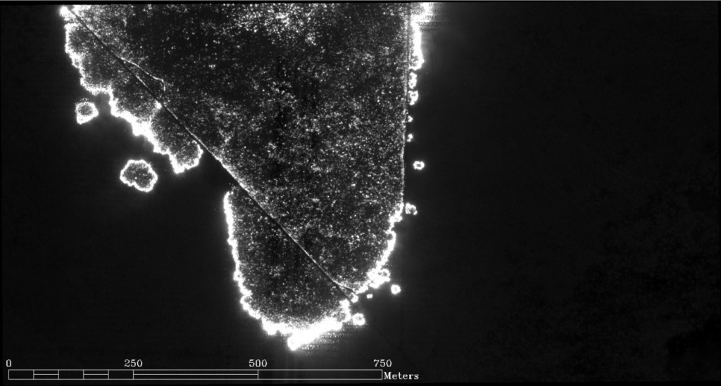
Applications for TABI-1800 include detection of underground tunnels, pipeline mapping, corridor mapping, heat loss surveys, and many other applications where there are even the subtlest temperature differences.
The TABI-1800 is a new breed of high-resolution airborne thermal mapper. It combines the following class-leading characteristics in a broadband thermal imaging package that can’t be matched:
Applications:
- Agriculture
- Environment
- Water Quality
- LIDAR, IFSAR
- Wildfire/Hotspot Mapping
- Defence
- Pipelines/Tunnels
- Heat Loss Mapping/Thermal Anomalies
Tabi-1800 specifications :
| ACROSS TRACK PIXELS | 1800 ± 5% |
|---|---|
| FIELD OF VIEW | 40°ree; ± 2% |
| IFOV | 0.023° (0.405 mrad) |
| NEDT | < 0.05° C |
| SPECTRAL RANGE | Midwave Infrared (3,700 – 4,800 nm) |
| NUMBER OF SPECTRAL BANDS | One (1) |
| COOLING | Stirling Cycle Cooler |
| THERMAL REFERENCE | Internal black body measurements – collected on every flight line |
| THERMAL DRIFT | Minimal |
| DYNAMIC RANGE | 14 bit |
| DATA RATE (MB/SEC) | 3.38 |
| FRAME RATE | ? 80fps |
| OPTICAL DISTORTION | < 0.05% |
| STANDARD TEMPERATURE MEASUREMENT RANGE | -20 to 150°C |
| IMU/GPS | Imbedded POS AV 410 (optional) |
| INTEGRATION WITH LIDAR | Yes |
| SPATIAL RESOLUTION AT AN AIRCRAFT SPEED OF 110 KNOTS AND ALTITUDE OF 5,679 FT AGL | 70 cm (flight line swath of 1.2 Km) |
Supporting Products:
- Applanix POS AV System
- Precision Geocor System
- Calibration System
- Real-Time Processing System
- MuSIC System
- Hyperspectral Image Analysis Software
- Remote Operation Capability
- Airworthiness Certification
- EMI Testing