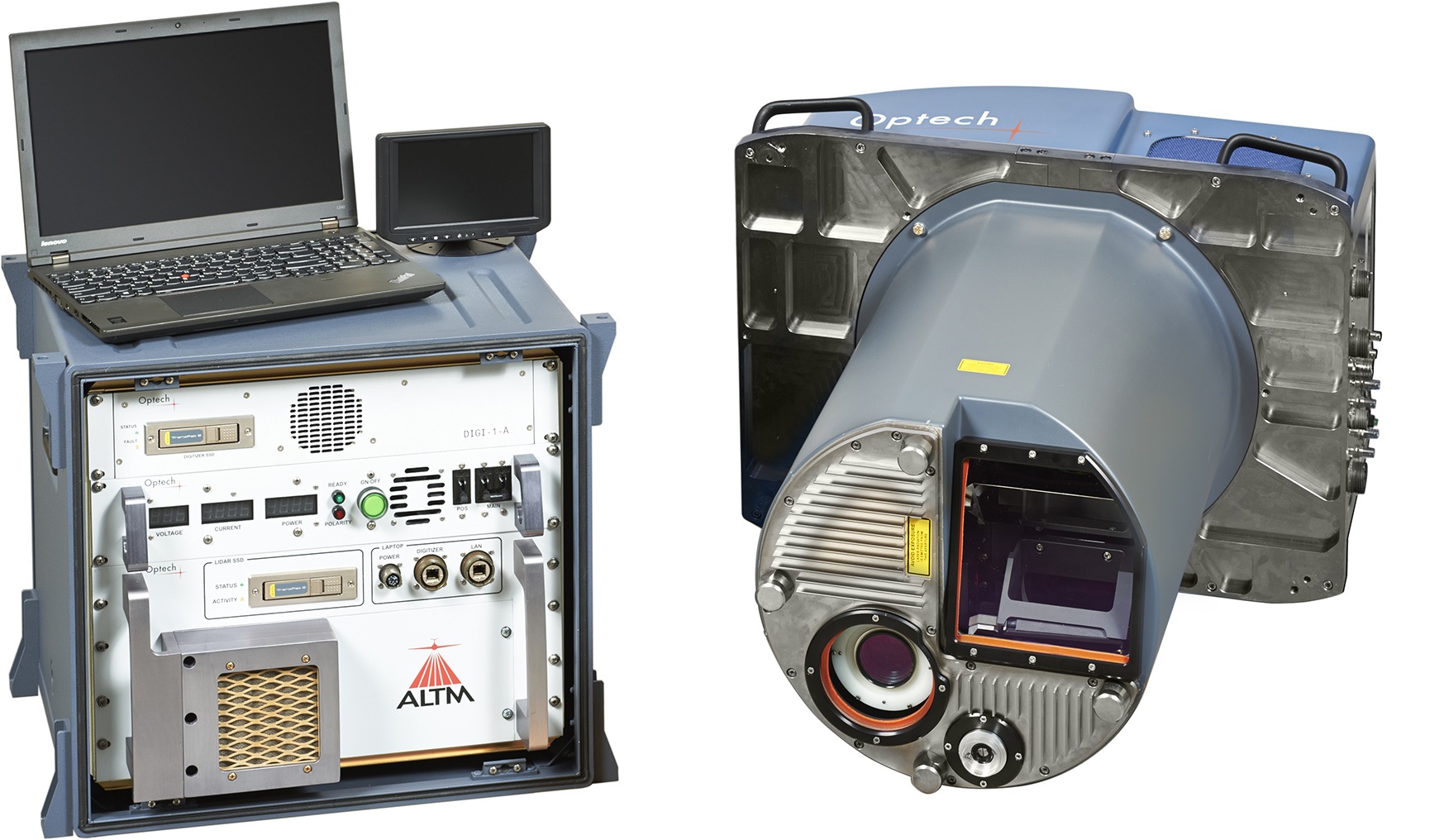
Optech ALTM Titan
A revolution in lidar applications!
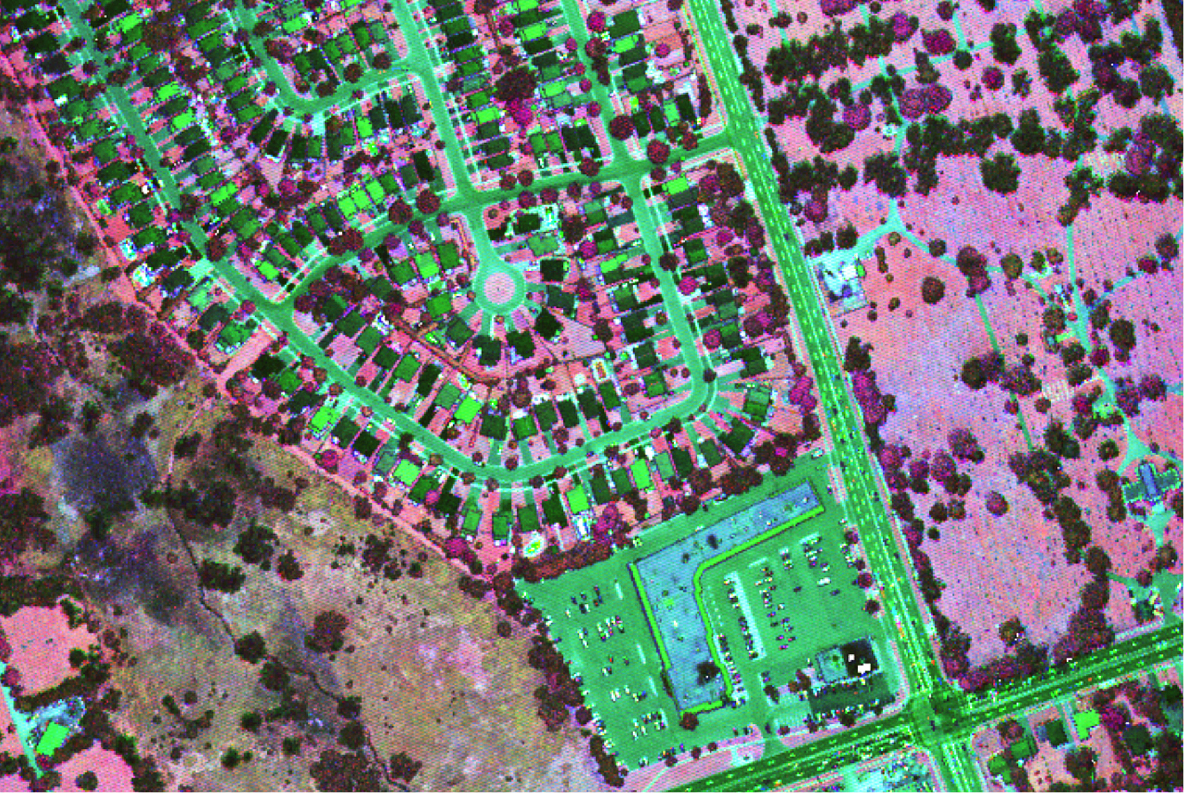
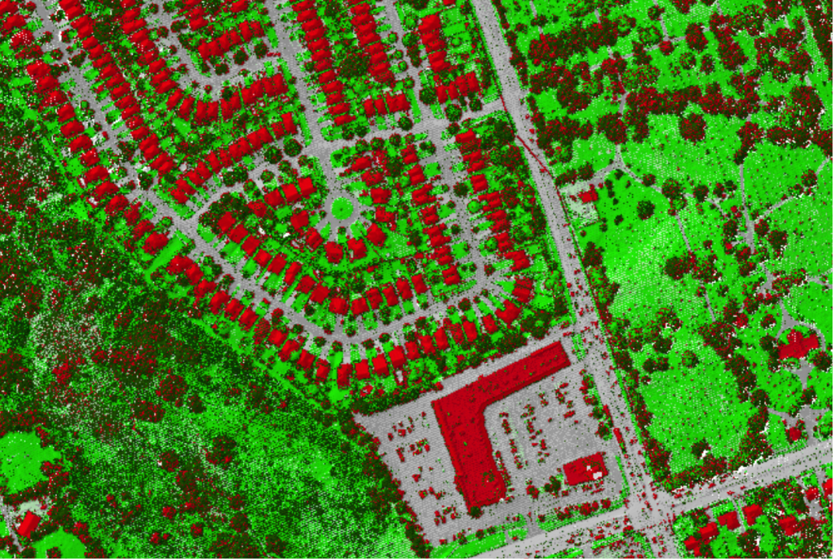
As the world’s first multispectral airborne lidar sensor, Optech Titan is opening up a new era in lidar survey and mapping. 3D surface spectral response information sensitive to the emitted wavelengths can now be derived day or night from complex environments using a single lidar sensor. Such information opens up exciting new applications and can significantly improve existing application results moving forward. Whether it is high density topographic surveying, seamless shallow water bathymetry, environmental modeling, impervious urban surface mapping, or vegetative classification, the Optech Titan breaks new ground in active sensor design and performance.
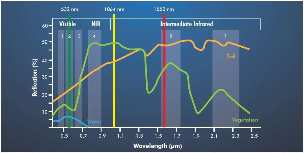
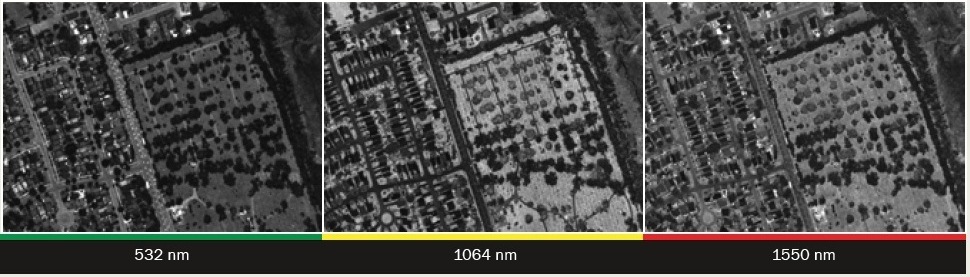
Titan’s standard configuration includes three active beams with independent wavelengths of 532 nm, 1064, nm and 1550 nm. Each beam has a 300 kHz effective sampling rate for a combined ground sampling rate of 900 kHz.
A 29MP fully-electronic interline camera provides high-resolution RGB imagery at frame rates >1/sec. Or upgrade to a 80MP orthometric camera with forward motion compensation. For dedicated environmental mapping initiatives consider the Optech CS-MS4100, a 3 to 5 band multispectral camera for the ultimate in fused information extraction.
Lidar point distribution is controlled using a fully-programmable scanner for significant point density increases at lesser FOVs. Manage point distribution and flight line consistency even further by adding a gyro-stabilized mount, or using Titan’s included roll-compensation feature.
The Titan workflow includes a comprehensive flight management system, Optech FMS, that leverages realtime point display capability, passive image support and waveform analysis for complete in-air collection confidence. Coupled with Optech LMS, the industry-leading lidar processing suite for automatic sensor calibration and project accuracy quantification, Titan is a high-productivity sensor with an efficient and comprehensive workflow.
One sensor, many applications. Look no further than the Optech Titan!
Titan advantages
- 900 kHz of high-density mapping capability
- Independent wavelengths, featuring “green” and NIR channels for topographic, shallow water bathymetry, vegetative mapping, and environmental modeling applications
- High-precision timing electronics, narrow laser pulse widths and select beam divergences guarantee the highest range precision and data quality possible
- Fully programmable scanner enables huge increases in point density at narrower FOVs for maximum target resolution and detail over competing sensors
- 29 MP high-resolution, fully electronic QA camera provides passive imagery support.
- Optional embedded 80 MP orthometric camera with forward motion compensation enhances resolution and provides best-of-class image quality
- Realtime XYZI point display, available exclusively with Optech FMS, enables independent channel visualization during flight for true-coverage verification and collection monitoring
- Fully-automatic GSM control by Optech FMS enables effortless operation
- Automatic water attenuation correction for bathymetric applications using Optech’s exclusive AquaDX software
- The latest in tightly-coupled inertial and Virtual Reference System processing technology enables steep turns, extended GPS baselines, and the elimination of remote base stations
- Optional CenterPoint RTX provides global coverage of centimeter-level real time position accuracy, a critical consideration for bathymetric mapping in remote locations (<0.1 m XY)
- Powerful Optech LMS lidar processing software automates sensor calibration, maximizes laser point accuracies and quantifies project accuracy deliverables
Applications
- Topographic mapping
- Land cover classification
- Seamless shallow water bathymetry
- Environmental modeling
- Forest inventory and vegetative classification
- Natural resource management
- Disaster response
Accessories
- Embedded multispectral, thermal, NIR or RGB camera system
- Full waveform recorder for each channel
- Gyro-stabilized survey kits