
UniScan™
UniScan™ – ground station for X-band data reception from polar-orbiting remote sensing satellites
State-of-the-art computer technologies make it possible to receive Earth imagery from space at personal computers. These images are a source of independent real-time information about natural sites and the infrastructure status. Thus this remotely sensed data becomes an indispensable tool to increase reliability of the decision support system. The UniScan™ technology is the best solution if the time factor is the most crucial issue for decision making and the situation analysis requires timely data. Such data acquisition at the station is the only way to get remotely sensed data from space in real time mode.
Today the UniScan™ stations developed at the R&D Center ScanEx provide for receiving both optical and all-weather round-the-clock radar images with a spatial resolution from 1 km to 0.7 m, thus making it possible to resolve a wide range of applied tasks.
One UniScan™ station covers area of about 12 million sq. km. This provides for the most efficient routine monitoring of the coverage zone without leaving the place of work. In addition the expenses for in-situ and aerial observations could be significantly reduced. The UniScan™ station is not only the tool for data acquisition but also a set of software products for this data storage, processing and thematic analysis.
In order to receive the majority of the presently available remotely sensed images especially those with a high spatial resolution, the corresponding licenses are required. The R&D Center ScanEx has signed licensed agreements with the world operators of the main Earth observing missions and consequently has a right to develop and manufacture ground stations for this data reception.
At present the network of national and regional remote sensing centers in Russia and abroad have been developed based on the UniScan™ technology. This proves in practice our idea about a decentralized access to images of the Earth from space. Such an approach gives a possibility to transfer traditional usage of remotely sensed data for scientific research projects into their practical applications within GIS technologies for decision making when managing territories, cities and even enterprises. To date, Earth monitoring from space becomes not just a distant future, but a reality due to the UniScan™ technology.
UniScan™ specifications :
UniScan™ hardware is universal and programmable. It provides for reception of information in any format, which parameters are within the following limits:
| Parameter | Range |
|---|---|
| Carrier frequency, MHz | 8,025…8,400 |
| 7,750…7,850 | |
| Digital data rate, Mbps | 7.0 ... 320 (QPSK) |
| 3.5 … 160 (BPSK) | |
| Modulation | BPSK, QPSK, SQPSK |
The users would not need any hardware modifications to adapt the station for a new satellite and format, only some additional software will be required provided that:
- format parameters are within the limits indicated above;
- power of the satellite transmission is sufficient to be received by the particular antenna system.
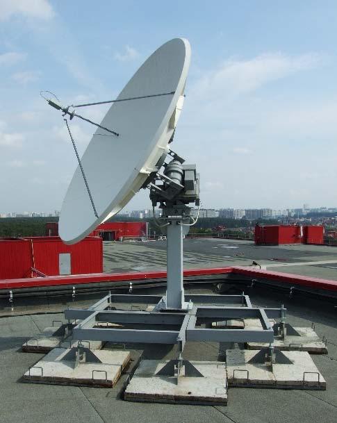
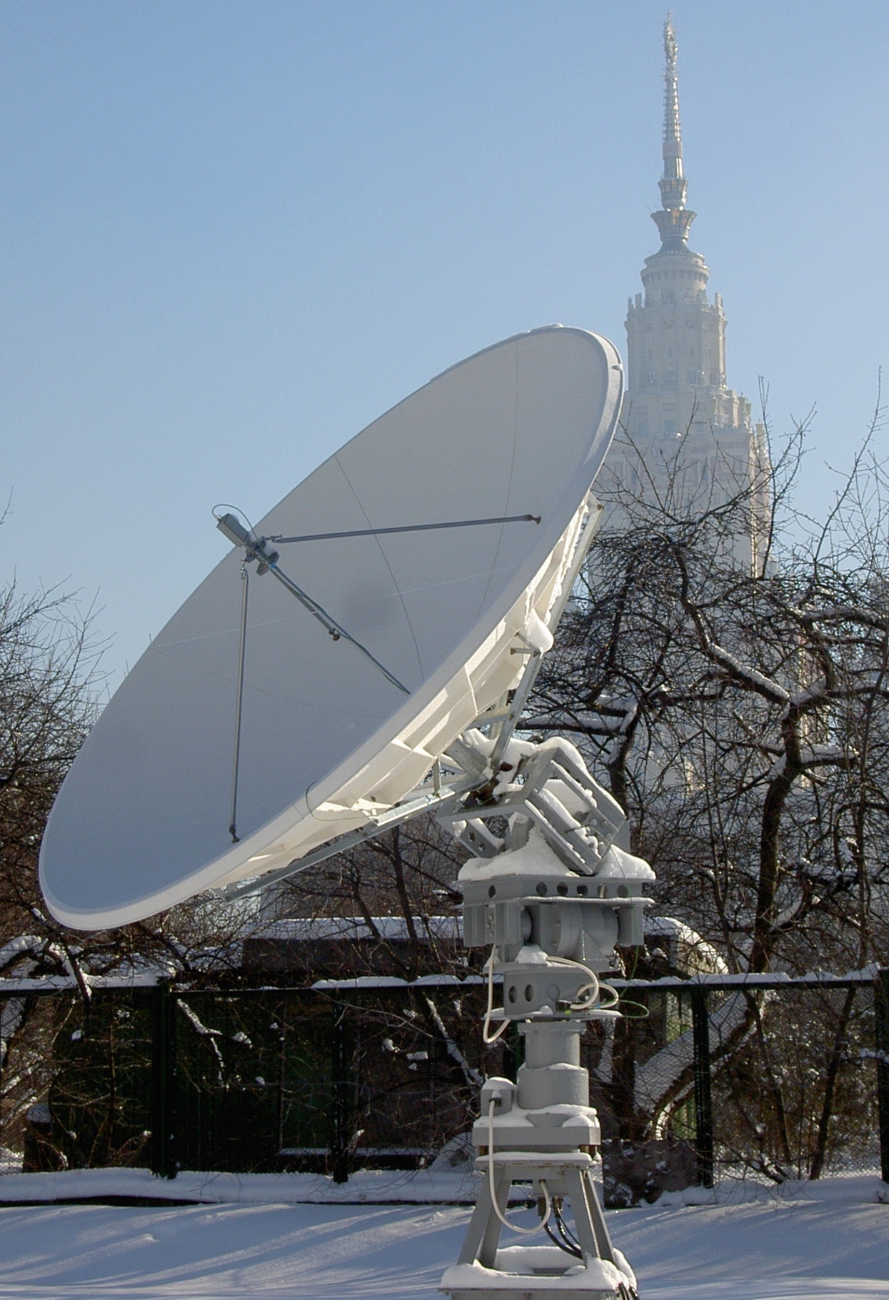
UniScan™ is supplied in two configurations:
- solid-reflector antenna, 3.1 m in diameter with a 3-axis positioner (UniScan™-36)
- solid-reflector antenna, 2.4 m in diameter with a 2-axis "X – Y" positioner (UniScan™-24)
Both of the stations provide for the acquisition without the “dead cone” in zenith.
The UniScan™-24 station is lighter and cheaper, but it needs considerably higher minimum satellite elevations for data acquisition (i.e. it has a smaller reception radius).
Applications:
The wide range of the data received by the UniScan™ station in terms of spatial resolution, swath width and spectral range, the frequent overall survey repeat period and the all-weather day-and-night capability of the radar imaging provide opportunities to apply these data in all kinds of practical tasks. The main application areas include:
- update of topographic maps (up to the scale of 1:10 000);
- operational detection and monitoring of oil spills on land and at sea;
- control over compliance with the licensing agreements in natural resources development;
- operational monitoring of the ice and snow cover;
- monitoring the state of agricultural lands, including the control over crop rotation and over the use of lands;
- rapid assessment of the status and the degree of degradation of crop and pasture lands;
- monitoring of hydraulic structures, such as river dams
- creation of up-to-date thematic maps (e.g. vegetation, soil cover condition, potential hazards in an area, etc.);
- creation of digital elevation models;
- environmental impact assessment;
- glacier monitoring;
- control over illegal fishing;
- land cadastre;
- update of forestry maps;
- early detection and monitoring of forest and grassland fires;
- rapid and objective damage assessment after natural disasters