
LandScan
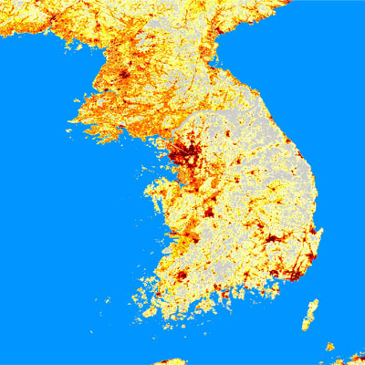
LandScan is global population distribution data having finest resolution available, it represents an ambient population (averaged over 24 hours). Landscan uses spatial data and imagery analysis and a multi-variable dasymetric modeling approach to dis-aggregate census counts within an administrative boundary. LandScan integrates daytime movements and collective travel habits into a single measure to produce a better representation of where people are located during an average day. With improvements added this year, high-resolution imagery sources were used extensively for validation to refine urban areas, land cover data, and thousands of smaller villages and populated places.
Why is Landscan important? Why not use census data?
Census data are generally collected assuming that people’s home are their permanent residing place. Work related data such as location of office or business are either not collected or are considered too private to be released publicly. Many undeveloped nations have only rudimentary data at provincial level. So we we can ask a question: so what?
Consider, for example, an hypothetical case of major multi-lane highway passing through a uninhabited desert. If a hazardous release contaminates the surrounding area many lives would be at risk even though no one lives there. Most official census counts, if available, will show zero population count because they are primarily concerned with where people sleep at night.
Taking another example of agricultural fields, they will show up as zero population count areas in case of a disaster because no one sleeps in a field. The same can said about airports, offices building and other work and travel related spaces.
Applications of LandScan
- Allows quick and easy assessment, estimation, and visualization of population at risk.
- Demographic (age, race, sex) and socioeconomic characteristics are integrated with population data to allow integration with risk and impact assessment models.
- Critical component of Emergency planning and management, Rapid risk assessment, Evacuation planning, Consequence assessment, Mitigation Planning and implementation.
Formats:
Landscan is available in ESRI grid format. The archive contains grids for the world and each of the six continents, excluding Antarctica. Each of the archive files contains two folders, an ArcInfo GRID folder and an INFO folder. Both folders must be extracted from the archive file into one new folder.
ESRI binary format. The archive contains contains raster binary data for the world and a rich text formatted file that describes the binary format. The binary raster file format is a simple format that can be used to transfer raster data among various applications. Almost any programming language can read this file directly.
For both formats, downloaded files need to be uncompressed using a standard Zip utility (e.g., WinZip, PKZIP, etc.) before they can be imported to GIS or other software. Users should expect a substantial increase in the size of downloaded data after uncompression.
Other Specifications:
- Projection: Geographic; UTM and other coordinate systems available
- Datum: WGS84
- Resolution: 0.00833 decimal degrees; 1x1km cell-size.