Worldview-2
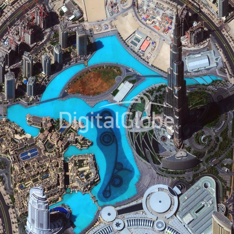
WorldView-2 satellite sensor from DigitalGlobe provides 8-band multispectral imagery. It was launched on October 8, 2009 from Vandenberg Air Force Base on a Delta II rocket to become DigitalGlobe’s third satellite in orbit, joining WorldView-1 which was launched in 2007 and QuickBird which was launched in 2001. It takes a new photograph of any place on Earth every 1.1 days. The overall objective was to meet the growing commercial demand for high-resolution satellite imagery (0.46 cm Pan, 1.8 m MS at nadir – representing one of the highest available spaceborne resolutions on the market).
Worldview-2 specifications
| Launch Information | Date: October 8, 2009 |
|---|---|
| Launch Vehicle: Delta 7920 (9 strap-ons) | |
| Launch Site: Vandenberg Air Force Base, California | |
| Orbit | Altitude: 770 km |
| Type: Sun synchronous, 10:30 am descending node | |
| Period: 100 min. | |
| Mission Life | 10-12 years, including all consumables and degradables (e.g. propellant |
| Spacecraft Size, Mass and Power | 5.7 m (18.7 ft) tall x 2.5 m (8 ft) across |
| 7.1 m (23 ft) across the deployed solar arrays | |
| 2615 kg (5765 lbs) | |
| 3.2 kW solar array, 100 Ahr battery | |
| Sensor Bands | Panchromatic: 450 – 800 nm |
| 8 Multispectral: | |
| Coastal: 400 – 450 nm Red: 630 -690 nm | |
| Blue: 450 – 510 nm Red Edge: 705 – 745 nm | |
| Green: 510 – 580 nm Near-IR1: 770 – 895 nm | |
| Yellow: 585 – 625 nm Near-IR2: 860 – 1040 nm | |
| Sensor Resolution | Panchromatic: 0.46 m GSD at nadir, 0.52 m GSD at 20° off-nadir |
| Multispectral: 1.85 m GSD at nadir, 2.07 m GSD at 20° off-nadir | |
| Dynamic Range | 11-bits per pixel |
| Swath Width | 16.4 km at nadir |
| Attitude Determination and Control | 3-axis stabilized |
| Actuators: Control Moment Gyros (CMGs) | |
| Sensors: Star trackers, solid state IRU, GPS | |
| Pointing Accuracy and Knowledge | 3-axis stabilized |
| Accuracy: <500 m at image start and stop | |
| Knowledge: Supports geolocation accuracy below | |
| Retargeting Agility | Time to Slew 200 km: 10 sec |
| Onboard Storage | 2199 Gb solid state with EDAC |
| Communications | Image and Ancillary Data: 800 Mbps X-band |
| Housekeeping: 4, 16 or 32 kbps real-time, 524 kbps | |
| stored, X-band | |
| Command: 2 or 64 kbps S-band | |
| Max Contiguous Area Collected in a Single Pass (30° off-nadir angle) | Mono: 138 x 112 km (8 strips) |
| Stereo: 63 x 112 km (4 pairs) | |
| Revisit Frequency (at 40°N Latitude) | 1.1 days at 1 m GSD or less |
| 3.7 days at 20° off-nadir or less (0.52 m GSD) | |
| Geolocation Accuracy(CE90) | Demonstrated <3.5 m CE90 without ground control |
| Capacity | 1 million km2 per day |
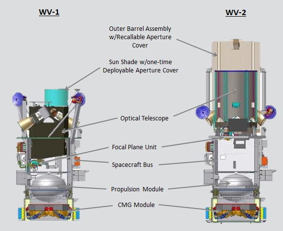
WorldView-2, like its predecessor WorldView-1, was designed by Ball Aerospace and Technologies Corporation. The advanced CMGs (Control Moment Gyroscopes) provided by Ball Aerospace for WorldView-2, as well as for DigitalGlobe’s WorldView-1, afford the satellites the flexibility to capture more imagery than ever before. This high-performance technology provides acceleration up to 10 times that of other attitude control actuators and improves both maneuvering and targeting capability, while reducing slew time from over 60 seconds to only 9 seconds to cover 300 km. This means WorldView-2 is able to rapidly swing precisely from one target to another, allowing extensive imaging of many targets, as well as stereo, in a single orbital pass.