
Pléiades 1B
Pléiades 1B Satellite Sensor
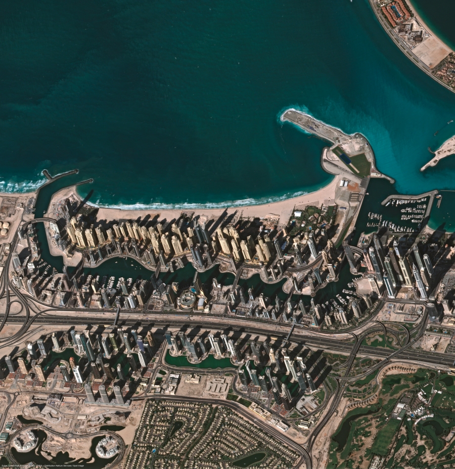
Pléiades 1B sensor was launched on 2nd December 2012. designed and constructed by Astrium France, this satellite was launched on board a Soyuz rocket from European Space Center’s launch pad in French Guiana.
About Pléiades 1A
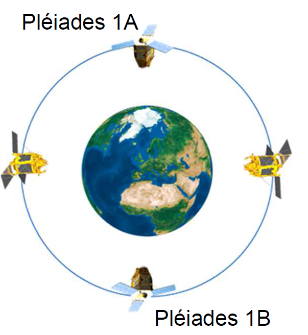
Pléiades 1B is second in the series of 2 satellites to be launched by France as part of the Orfeo programme. The Orfeo programme is a project of the European Space Agency scheduled for completion in 2017. It’s composed of 6 next-generation, high-resolution satellites. Pleiades 1A and Pleiades 1B being the french part of the programme and 4 Cosmo-Skymed X-band satellites being the Italian part.
Specifications
| Resolution | Panchromatic 50 cm |
|---|---|
| Multispectral 2.0 m | |
| Nominal Swath Width | 20km at Nadir |
| Bands | Pan: 450-830 nm |
| Blue: 430-550 nm | |
| Green: 500-620 nm | |
| Red: 590-710 nm | |
| Near IR: 740-940 nm | |
| Archive Availability | From September 2012 |
| Programmability | YES |
| Minimum Area of Purchase | 25 sqkms for Archive Imagery |
| 100 sqkms for New Collect imagery | |
| Stereo Available | YES |
| Best Scale | 1 : 2000 |
Defining Characteristics
The Pleiades constellation consists of 180 degrees phased twin satellites Pleiades 1A and Pleiades 1B. Both satellites are operated by Astrium using a single unified interface thereby leveraging true capacity of the constellation.
Pleiades sensors offer largest swath of any current sub-meter resolution sensor. The daily maximum capacity of 1 million sqkm per satellite is unrivaled by today’s satellites. Each scene footprint covers 400 sqkm area in spirit of SPOT family providing wide area coverage.
Products:
Following products are available from Pleiades:
Both satellites provide Panchromatic, Multispectral (4 bands), Pansharpened 3 band true colour (BGR), Pansharpened 3 band false colour (RGNIR) or Bundle imagery. Products from either sensor are of exactly same quality and accuracy. Geometry wise Primary and Ortho products will be available. Orthorectification facilitates the management of several layers of products, from the same sensor or others, while reducing local data gaps that can be caused by different viewing angles or relief prallax between various image strips. The standard 3D model used for ground corrections is the worldwide Elevation30 dataset (also known as Reference3D).
Applications:
Pleiades-1A and 1B will enable daily revisits to any location on earth which makes it ideal for mapping large scale areas including engineering and construction projects, monitoring of mining, Environment, conflict zones and crisis/disaster areas, natural hazards, evacuation and rescue operations.