
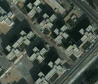
QuickBird
DigitalGlobe’s QuickBird satellite offers sub-meter resolution imagery. Previously at an operational altitude of 482 km, QuickBird is currently operating at an altitude of 450 km and will continue in an gradual descent until its end of mission life at an altitude of 300 km.
QuickBird provides commercial imagery at 0.61 m (PAN) and at 2.4 m (MS) resolution. A successful launch of QuickBird took place on Oct. 18, 2001 on a Delta-2 vehicle of Boeing from Vandenberg Air Force Base, USA.
Trivia:
In 2001 the QuickBird project of DigitalGlobe opted for a fairly low orbital altitude of 450 km (from the previous 600 km altitude level) to obtain a higher ground spatial resolution of the imagery; however, at the expense of swath width. Naturally, the low orbit of 450 km requires more orbit raising maneuvers due to the increased drag influence of the atmosphere. The argument went that the S/C carries enough fuel to adjust the lower orbit more frequently over the operational lifetime of the mission. (source: eoportal.org)
Specification:
| Launch information | Date: October 18, 2001 |
|---|---|
| Launch vehicle: Delta II | |
| Launch Site: SLC-2W, Vandenberg Air Force Base, California | |
| Mission life | Extended through mid-2014 |
| Spacecraft size | 2400 lbs, 3.04 m (10 ft) in length |
| Altitude 450 km | Altitude 300 km | |
|---|---|---|
| Orbit | Type: Sun-synchronous, 10:00 am descending node | 10:00 am descending node |
| Period: 93.6 min | Period: 90.4 min | |
| Sensor resolution and spectral bandwidth | Panchromatic: 61 cm GSD at nadir | Panchromatic: 41 cm GSD at nadir |
| B&W: 405 – 1053 nm | ||
| Multispectral: 2.44 m GSD at nadir | Multispectral: 1.63 m GSD at nadir | |
| Blue: 430 – 545 nm | ||
| Green: 466 – 620 nm | ||
| Red: 590 – 710 nm | ||
| Near IR: 715 – 918 nm | ||
| Dynamic range | 11-bits per pixel | |
| Swath width | Nominal swath width: 16.8 km at nadir | Nominal swath width: 11.2 km at nadir |
| Attitude determination and control | Type: 3-axis stabilized Star tracker/IRU/reaction wheels, GPS | |
| Retargeting agility | Time to slew 200 km: 38 sec | 44 sec |
| Onboard storage | 128 Gb capacity | |
| Communications | Payload data: 320 Mbps X-band | |
| Housekeeping: X-band from 4,16 and 256 Kbps, 2 Kbps S-band uplink | ||
| Revisit frequency (at 40°N latitude) | 2.4 days at 1 m GSD or less | 2.1 days at 1 m GSD or less |
| 5.9 days at 20° off-nadir or less | 8.7 days at 20° off-nadir or less | |
| Metric accuracy | 23 m CE90, 17 m LE90 (without ground control) | |
| Capacity | 200,000 km2 per day | 100,000 km2 per day |
