Pléiades 1A
Pléiades 1A Satellite Sensor
First satellite to be launched for creation of Pleiades constellation was Pleiades 1A. It was launched in December, 2011 from French Guiana.
About Pléiades 1A
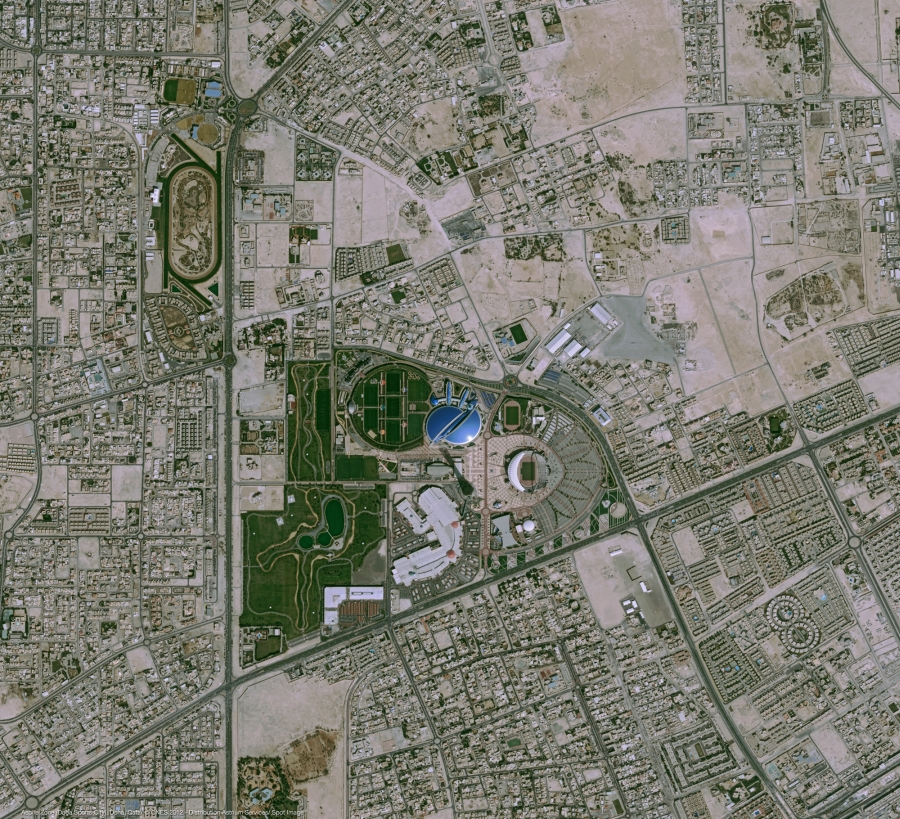
The Pleiades-1A constellation provides very-high-resolution optical products in record time, offering daily revisits to any point on the globe and acquisition capabilities tailored to meet the full spectrum of civil and military requirements.
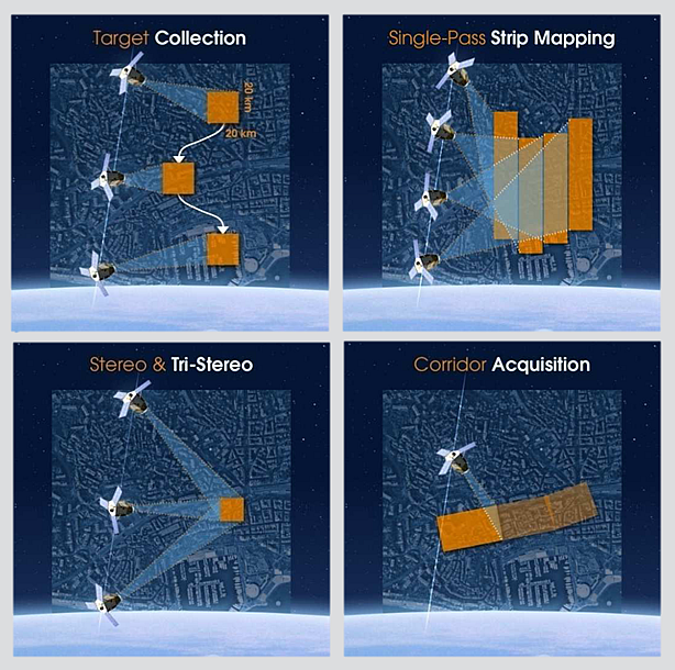
Pleiades swath covers 20 km at nadir, the satellites’ high agility allows to acquire in the same pass a mosaic of images covering a larger area (up to 120km*120km), or stereoscopic images of 300 km long. In all cases, minimum area is 25 sq.km. for archive imagery and 100 sq.km. for tasked imagery, with a width of at least 5km in any direction for tasked imagery (500m for archive imagery). User can select acquisition according area, 5 acquisition modes are there Target, Strip Mapping, Tri-stereo, Cont Surveillance. Please contact us for Pleiades imagery price list.
Specifications
| Resolution | Panchromatic 50 cm |
|---|---|
| Multispectral 2.0 m | |
| Nominal Swath Width | 20km at Nadir |
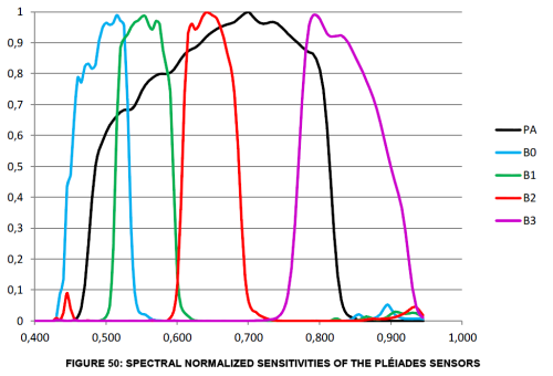
| Bands | Pan: 450-830 nm |
| Blue: 430-550 nm | |
| Green: 500-620 nm | |
| Red: 590-710 nm | |
| Near IR: 740-940 nm | |
| Archive Availability | From September 2012 |
| Programmability | YES |
| Minimum Area of Purchase | 25 sqkms for Archive Imagery |
| 100 sqkms for New Collect imagery | |
| Stereo Available | YES |
| Best Scale | 1 : 2000 |
Products:
Following products are available from Pleiades:
Both satellites provide Panchromatic, Multispectral (4 bands), Pansharpened 3 band true colour (BGR), Pansharpened 3 band false colour (RGNIR) or Bundle imagery. Products from either sensor are of exactly same quality and accuracy. Geometry wise Primary and Ortho products will be available. Orthorectification facilitates the management of several layers of products, from the same sensor or others, while reducing local data gaps that can be caused by different viewing angles or relief prallax between various image strips. The standard 3D model used for ground corrections is the worldwide Elevation30 dataset (also known as Reference3D).
Spectral Properties of the Sensor: