CZMIl
The most powerful airborne coastal and marine mapping system on the market
Powerful and affordable coastal and marine mapping system
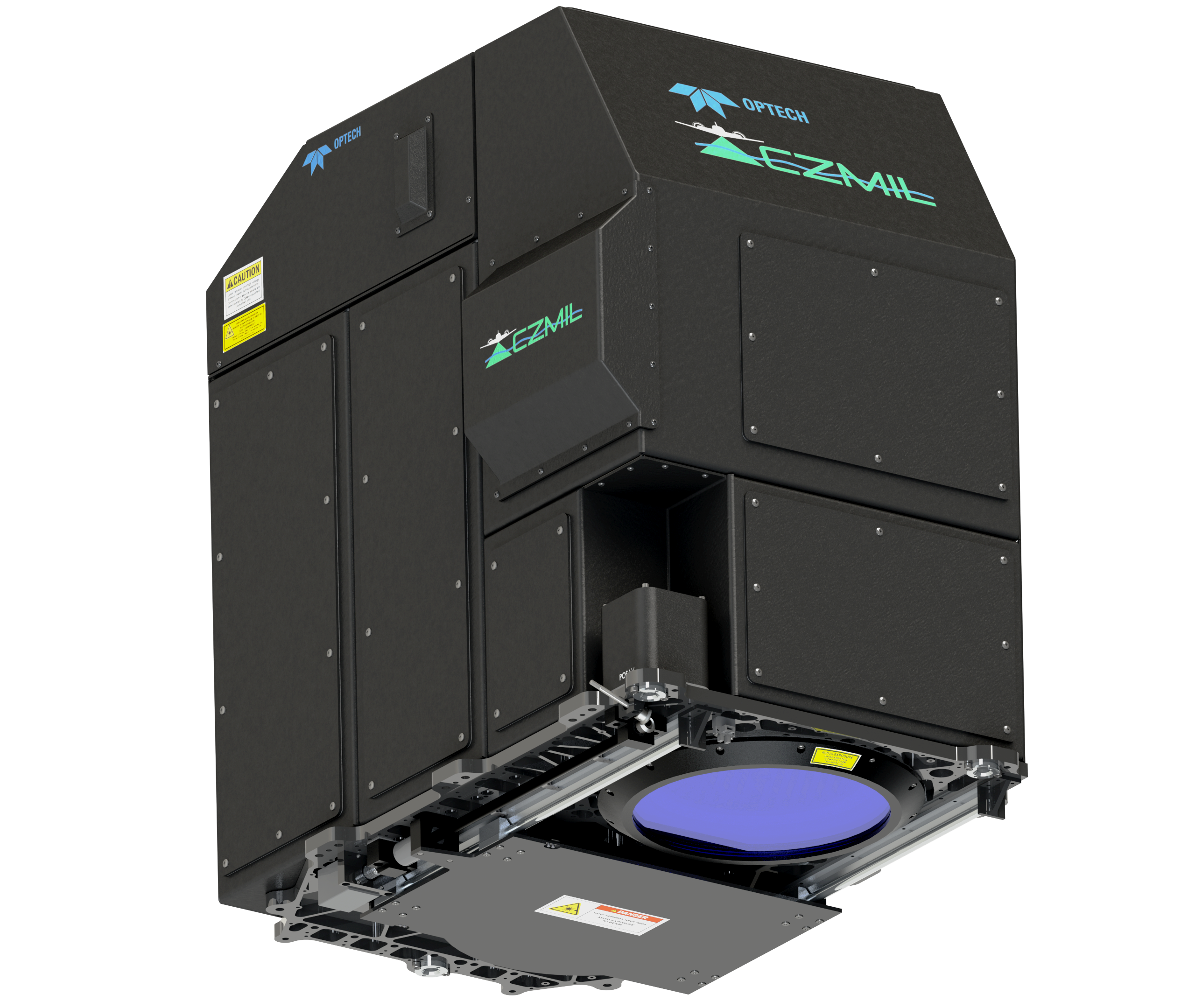
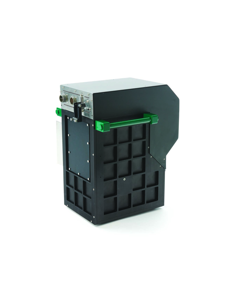
Optech CZMIL is not only the most capable airborne bathymetric mapping system available today; it is also the most efficient. With a powerful green laser, it maps deeper while flying higher, reaching depths of 80 meters in clear waters. The innovative design and automated processing tools produce simultaneous high-resolution 3D data and imagery of the beach and shallow water seafloor, including coastal topography, bathymetry, benthic classification and water column characterization. CZMIL is proven to outperform other bathymetric sensors in shallow, turbid waters. Its bathymetric lidar is integrated with a hyperspectral imaging system and digital metric camera. Optech HydroFusion, a powerful end-to-end software suite, handles data from all three sensors—from mission planning to post- processing, delivering fused lidar and imagery datasets, bottom classifications, and even submerged object detection. CZMIL HydroFusion won the MAPPS Geospatial Products and Services Excellence Award for Technology Innovation.
CZMIL Advantages
- Validated and in use by multiple government agencies
- Best seamless, simultaneous high-resolution topographic/bathymetric imaging
- Depth penetration of 2.5 × Secchi depth, up to 80 m
- Highest performance in shallow or turbid water
- Detects objects as small as 1 meter cube in water up to 25 meters deep
- Green and IR frequencies available in a single system
- Superior land/water discrimination and depth resolution
- Optimized coverage, spatial density and survey rate
- Sampling rate of 10 kHz in hydrographic mode and up to 70 kHz in topographic mode
- Best operational productivity with all-in-one HydroFusion software workflow

CZMIL Project Program
The CZMIL Project Program is a way that organizations of various types and sizes can realistically consider using a system as powerful as CZMIL. As this amazing technology has developed, only large government agencies had access to its advantages. They often need the capabilities of such a system for extended periods, which is why several have invested significantly in owning their own CZMIL system. However, some organizations may only need such a sophisticated system as CZMIL for a short period of time, for specific projects. For these organizations, it makes little sense to purchase a system and invest in personnel and equipment to support its maintenance and operation. The CZMIL Project Program provides the perfect solution, providing full use of a CZMIL system along with highly skilled technical and logistical support. It is a complete package of system and services in and of itself, though also offers flexible options to meet special project and organizational needs.
Accessories
- RGB Cameras
- Hyperspectral Cameras
Applications:
- Coastal & Marine
- Coastal & Shoreline
- Disaster Management
- Shallow, Turbid & Muddy Water
- Submerged Object Detection
- Defense & Security
- Natural Resources
- Environmental